

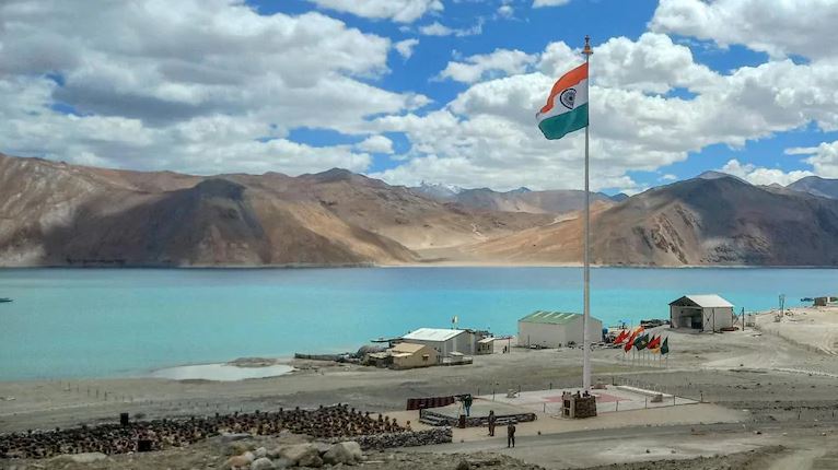
By formally naming 28 geographical features in Ladakh, including locations in Aksai Chin and friction points from the 2020 standoff, India is turning its territorial claims into permanent official records – a clear message to Beijing that New Delhi will not allow the disputed areas to be normalised as Chinese territory.
India’s decision to standardise and officially name 28 geographical features in Ladakh is more than an exercise in cartographic housekeeping. It is a carefully calibrated assertion of sovereignty at a time when China continues to contest India’s territorial claims and uses maps, place names and administrative nomenclature as instruments of state policy.
Coming within months of a similar exercise in Arunachal Pradesh, the Ladakh initiative indicates that New Delhi is increasingly prepared to respond to what it regards as China’s “cartographic aggression” in kind.
The significance of the move lies not merely in the number of places identified, but in where some of them are located. The list includes geographical features in areas claimed by India but controlled by China, including parts of Aksai Chin, as well as locations associated with the prolonged military confrontation along the Line of Actual Control (LAC).
By putting these names on the official Survey of India map, the government is effectively creating a permanent administrative and cartographic record of India’s territorial position. The message to Beijing is unmistakable: control on the ground does not translate into acceptance of sovereignty.
From cartography to strategic signalling
China has for years used place names to reinforce its territorial claims, particularly in Arunachal Pradesh. Beijing has repeatedly announced Chinese names for locations there, describing the Indian state as part of “Zangnan” or Southern Tibet.
India has consistently rejected these claims, arguing that changing names cannot alter sovereignty.
The latest exercise in Ladakh takes that argument a step further. Instead of merely rejecting Chinese nomenclature through diplomatic statements, India is institutionalising its own nomenclature through official maps and records.
The Home Ministry said the exercise was intended to remove “any ambiguity or misplaced perception” regarding land areas, peaks, mountains, passes, glaciers and water bodies in Ladakh, including those bordering Chinese-occupied Tibet, and to facilitate their “accurate recognition and better awareness among the people at large”.
That language is significant. The exercise is aimed not only at China but also at establishing an unambiguous Indian administrative narrative for government agencies, researchers, cartographers and the public.
In a territorial dispute where maps have increasingly become instruments of political messaging, the map itself becomes a statement of sovereignty.







Comments
0 commentsNo comments yet — be the first.